
The Eastern and Western Cape provinces can expect snowfall on Tuesday, according to the South African Weather Service, with some areas experiencing cool to cold weather.
Disruptive snowfalls leading to temporary road closures of mountain passes are expected between the Little Karoo western and northern high ground of the Eastern Cape.
Other warnings
- High seas with wave heights between 6.0m and 9.0m are expected between Cape Agulhas and Port St Johns in the morning.
- Storm surge is expected between Plettenberg Bay and East London in the morning.
- Gale force westerly winds (65-80km/h) are expected between Cape St Francis and East London in the morning.
The South African Weather Service has also issued the following special weather advisory:
- Light snowfalls are expected over the eastern high ground of the Western Cape, southern high ground of the Northern Cape and to the high ground of the Eastern Cape overnight into Tuesday morning.
- Strong interior winds of 50km/h to 65km/h are expected over the interior of the Western Cape, southern interior of the Northern Cape, southern parts of the Free State and the interior of the Eastern Cape.
- Very cold conditions are expected over the interior of the Western Cape, southern interior of the Northern Cape, northern interior of the Eastern Cape and southern parts of the Free State on Tuesday.
- Frost is expected over the northern interior of the Eastern Cape, the Free State and the southern and eastern parts of the Northern Cape on Wednesday morning.
The weather in your region
It will be fine and cool in Gauteng , becoming cold from the south in the afternoon. The expected UVB sunburn index is low.
Mpumalanga will be fine and cool, becoming cloudy with evening drizzle and fog along the escarpment.
Limpopo will be fine and warm, becoming partly cloudy with evening fog along the escarpment.
It will be fine and cold to cool in the North West .
The Free State will be fine in the east, otherwise partly cloudy and cold to very cold.
In the Northern Cape , it will be partly cloudy and cold to very cold, becoming fine in the central and northern parts. Rain and showers are expected over the south-western parts at first, with snowfalls over the southern high ground in the morning.The wind along the coast will be moderate south-westerly.
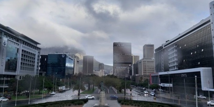
In the Western Cape , it will be cloudy and cold with rain showers over most of the province in the morning, but persisting along the south coast throughout the day.
Snowfalls can be expected over most of the province's mountain ranges in the morning, abating from the west during the afternoon. The wind along the coast will be fresh to strong south-westerly along the south coast, otherwise fresh southerly. The expected UVB sunburn index is low.
The western half of the Eastern Cape will be cloudy and cold but very cold in the north-east, with scattered showers but widespread along the coast. Snowfalls can be expected on the higher ground areas from morning. The wind along the coast will be fresh to strong south-westerly, reaching gale force at times in the morning.
In the eastern half of the Eastern Cape, it will be cloudy and cold but very cold in the north, with isolated showers but scattered along the sunshine coast. Snowfalls can be expected on the northern higher ground areas from morning.The wind along the coast will be fresh to strong south-westerly.
KwaZulu-Natal will be cloudy but partly cloudy in the west, and cool but cold over the interior.Isolated showers and rain are expected, except in the north-west. The wind along the coast will be moderate northerly to north-easterly north of Richards Bay at first, otherwise fresh to strong south-westerly. The expected UVB sunburn index is moderate.
-
Click here to see the specific forecast for your city over the next few days Snowfall expected in Eastern, Western Cape provinces on Tuesday Snowfall expected in Eastern, Western Cape provinces on Tuesday News24 26th May 2020, 04:10 GMT+10
The Eastern and Western Cape provinces can expect snowfall on Tuesday, according to the South African Weather Service, with some areas experiencing cool to cold weather.
Disruptive snowfalls leading to temporary road closures of mountain passes are expected between the Little Karoo western and northern high ground of the Eastern Cape.
Other warnings
- High seas with wave heights between 6.0m and 9.0m are expected between Cape Agulhas and Port St Johns in the morning.
- Storm surge is expected between Plettenberg Bay and East London in the morning.
- Gale force westerly winds (65-80km/h) are expected between Cape St Francis and East London in the morning.
The South African Weather Service has also issued the following special weather advisory:
- Light snowfalls are expected over the eastern high ground of the Western Cape, southern high ground of the Northern Cape and to the high ground of the Eastern Cape overnight into Tuesday morning.
- Strong interior winds of 50km/h to 65km/h are expected over the interior of the Western Cape, southern interior of the Northern Cape, southern parts of the Free State and the interior of the Eastern Cape.
- Very cold conditions are expected over the interior of the Western Cape, southern interior of the Northern Cape, northern interior of the Eastern Cape and southern parts of the Free State on Tuesday.
- Frost is expected over the northern interior of the Eastern Cape, the Free State and the southern and eastern parts of the Northern Cape on Wednesday morning.
The weather in your region
It will be fine and cool in Gauteng , becoming cold from the south in the afternoon. The expected UVB sunburn index is low.
Mpumalanga will be fine and cool, becoming cloudy with evening drizzle and fog along the escarpment.
Limpopo will be fine and warm, becoming partly cloudy with evening fog along the escarpment.
It will be fine and cold to cool in the North West .
The Free State will be fine in the east, otherwise partly cloudy and cold to very cold.
In the Northern Cape , it will be partly cloudy and cold to very cold, becoming fine in the central and northern parts. Rain and showers are expected over the south-western parts at first, with snowfalls over the southern high ground in the morning.The wind along the coast will be moderate south-westerly.
In the Western Cape , it will be cloudy and cold with rain showers over most of the province in the morning, but persisting along the south coast throughout the day.
Snowfalls can be expected over most of the province's mountain ranges in the morning, abating from the west during the afternoon. The wind along the coast will be fresh to strong south-westerly along the south coast, otherwise fresh southerly. The expected UVB sunburn index is low.
The western half of the Eastern Cape will be cloudy and cold but very cold in the north-east, with scattered showers but widespread along the coast. Snowfalls can be expected on the higher ground areas from morning. The wind along the coast will be fresh to strong south-westerly, reaching gale force at times in the morning.
In the eastern half of the Eastern Cape, it will be cloudy and cold but very cold in the north, with isolated showers but scattered along the sunshine coast. Snowfalls can be expected on the northern higher ground areas from morning.The wind along the coast will be fresh to strong south-westerly.
KwaZulu-Natal will be cloudy but partly cloudy in the west, and cool but cold over the interior.Isolated showers and rain are expected, except in the north-west. The wind along the coast will be moderate northerly to north-easterly north of Richards Bay at first, otherwise fresh to strong south-westerly. The expected UVB sunburn index is moderate.
-
Click here to see the specific forecast for your city over the next few days Read This Next